
Kód: 06815480
Remote Sensing and the Kyoto Protocol
Autor Stefan Hasenauer
The Kyoto Protocol to the United Nations FrameworkConvention on Climate Change (Kyoto Protocol) is oneof the most outstanding and ambitious environmentalprogrammes so far, established for reducinggreenhouse gases to prevent anthro ... celý popis
- Jazyk:
 Angličtina
 - Vazba: Brožovaná
- Počet stran: 76
Nakladatelství: VDM Verlag Dr. Mueller E.K., 2008
- Více informací o knize

Mohlo by se vám také líbit
-

British National Cinema
5031 Kč -

W lz-Bohrreibung
1676 Kč -

Evolutionary Biology Papers of Elie Metchnikoff
3037 Kč -

Lord Foulgrin's Letters
340 Kč
Dárkový poukaz: Radost zaručena
- Darujte poukaz v libovolné hodnotě a my se postaráme o zbytek.
- Poukaz se vztahuje na celou naši nabídku.
- Elektronický poukaz vytisknete z e-mailu a můžete ihned darovat.
- Platnost poukazu je 12 měsíců od data vystavení.
Více informací o knize Remote Sensing and the Kyoto Protocol
Nákupem získáte 138 bodů
 Anotace knihy
The Kyoto Protocol to the United Nations FrameworkConvention on Climate Change (Kyoto Protocol) is oneof the most outstanding and ambitious environmentalprogrammes so far, established for reducinggreenhouse gases to prevent anthropogenic climatechange. Changes in land-use and forestry have a greatimpact on the greenhouse gas balance, andparticipating countries are obliged to monitor andreport the status of their inventories. Remotesensing is, amongst others, a valuable technique forreporting in the sector Land Use, Land-Use Changeand Forestry (LULUCF). The author introduces thesubject by explaining basic terms and definitions ofthe Kyoto Protocol, and examines the usage of remotesensing in forest inventories, with a specialemphasis on the situation in Austria. After anin-depth review of official documentation of theIntergovernmental Panel on Climate Change (IPCC),like The Good Practice Guidance for Land Use,Land-Use Change and Forestry , the author presentsrecent and future trends in remote sensing. This bookwill be of interest to researchers and practitionersin the field of remote sensing, geography, forestry,and environmental sciences. The Kyoto Protocol to the United Nations Framework§Convention on Climate Change (Kyoto Protocol) is one§of the most outstanding and ambitious environmental§programmes so far, established for reducing§greenhouse gases to prevent anthropogenic climate§change. Changes in land-use and forestry have a great§impact on the greenhouse gas balance, and§participating countries are obliged to monitor and§report the status of their inventories. Remote§sensing is, amongst others, a valuable technique for§reporting in the sector Land Use, Land-Use Change§and Forestry (LULUCF). The author introduces the§subject by explaining basic terms and definitions of§the Kyoto Protocol, and examines the usage of remote§sensing in forest inventories, with a special§emphasis on the situation in Austria. After an§in-depth review of official documentation of the§Intergovernmental Panel on Climate Change (IPCC),§like The Good Practice Guidance for Land Use,§Land-Use Change and Forestry , the author presents§recent and future trends in remote sensing. This book§will be of interest to researchers and practitioners§in the field of remote sensing, geography, forestry,§and environmental sciences.
 Parametry knihy
Zařazení knihy Knihy v angličtině Earth sciences, geography, environment, planning Geography
1375 Kč
- Plný název: Remote Sensing and the Kyoto Protocol
- Podnázev: Focus on Land Use, Land-Use Change and Forestry
- Autor: Stefan Hasenauer
- Jazyk:
 Angličtina
 - Vazba: Brožovaná
- Počet stran: 76
- EAN: 9783639060843
- ISBN: 3639060849
- ID: 06815480
- Nakladatelství: VDM Verlag Dr. Mueller E.K.
- Hmotnost: 122 g
- Rozměry: 153 × 229 × 6 mm
- Datum vydání: 21. August 2008
Oblíbené z jiného soudku
-

Oxford IB Diploma Programme: Geography Course Companion
1786 Kč -

Cambridge International AS and A Level Geography Skills Workbook
544 Kč -

DANUBE BIKE TRAIL 1 DONAUESCHINGEN TO PA
366 Kč -

Birds of New Guinea
1215 Kč -

Cambridge International AS and A Level Geography second edition
2068 Kč -

Human Geography
1251 Kč -

Geography: An Integrated Approach
2270 Kč -

IB Geography Study Guide: Oxford IB Diploma Programme
1194 Kč -

LADAKH ZANSKAR OLIZANE RV WP
790 Kč -

West Midlands A-Z Street Atlas (spiral)
588 Kč -

ALBANIA RKH RV R WP GPS
280 Kč -

Future of Packaging
611 Kč -

IB Geography Course Book: Oxford IB Diploma Programme
1153 Kč -

Cambridge International AS & A Level Geography Student's Book
1264 Kč -

Justinianic Mosaics of Hagia Sophia and Their Aftermath
2692 Kč -
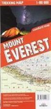
terraQuest Trekking Map Mount Everest
278 Kč -

comfort! map USA
340 Kč -

Level Geography Fieldwork & Skills
1577 Kč -

Birds of Hawaii and Micronesia
657 Kč -

Geography
1675 Kč -

Essential Maths Skills for AS/A-level Geography
409 Kč -

Dictionary of Physical Geography, 4e
1162 Kč -

Do Earth
258 Kč -

Economic Geography - A Contemporary Introduction 3e
1162 Kč -

Geography for Cambridge International AS and A Level Revision Guide
850 Kč -

Butterflies of Europe
827 Kč -

Incredible History of India'a Geography
291 Kč -

History of the Adriatic: A Sea and Its Civilizatio n Cloth
632 Kč -

comfort! map Sweden
284 Kč -

Birds of Prey of the East
550 Kč -

Porto - Michelin City Plan 85
198 Kč -

Garibaldi
1664 Kč -

Urban Planning Imagination - A Critical International Introduction
587 Kč -

Geology of Egypt
925 Kč -

OCR A2 Geography Textbook
224 Kč -

Once Within Borders
752 Kč -

New Literary History of Modern China
1262 Kč -

Birds of Prey of the West
601 Kč -

IB Diploma
1035 Kč -
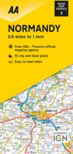
Road Map Normandy
328 Kč -

Publics and the City
1217 Kč -

Biogeography and biomorphology
619 Kč -
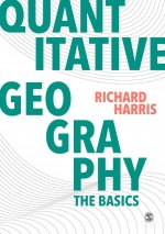
Quantitative Geography
1100 Kč -

Invention of Humanity
1720 Kč -

Havana / Cuba Central
288 Kč -

Planetary Social Thought
706 Kč -

Saint Kitts / Nevis
483 Kč -

Edexcel GCE Geography Y2 A Level Student Book and eBook
1203 Kč -
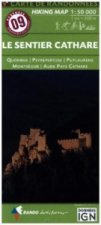
Pyrénées Carte 09 Le Sentier Cathare 1
361 Kč
Osobní odběr Praha, Brno a 12903 dalších
Copyright ©2008-24 nejlevnejsi-knihy.cz Všechna práva vyhrazenaSoukromíCookies


 Vrácení do měsíce
 571 999 099 (8-15.30h)